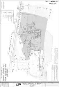
Providing accurate elevation data and digital terrain models to facilitate successful design of projects ranging in size from small parcels to several thousand acres. Lawson Surveying & Mapping utilizes the latest technology to fit project cost and scheduling needs
Lawson Surveying & Mapping | 5546 State Highway 7, Suite1 | Oneonta NY 13820 | Phone 607-432-3300 | Fax 607-432-8313 | Toll Free 800-491-1868 | Email: info@lawsonsurvey.com Theme by Flythemes